

About
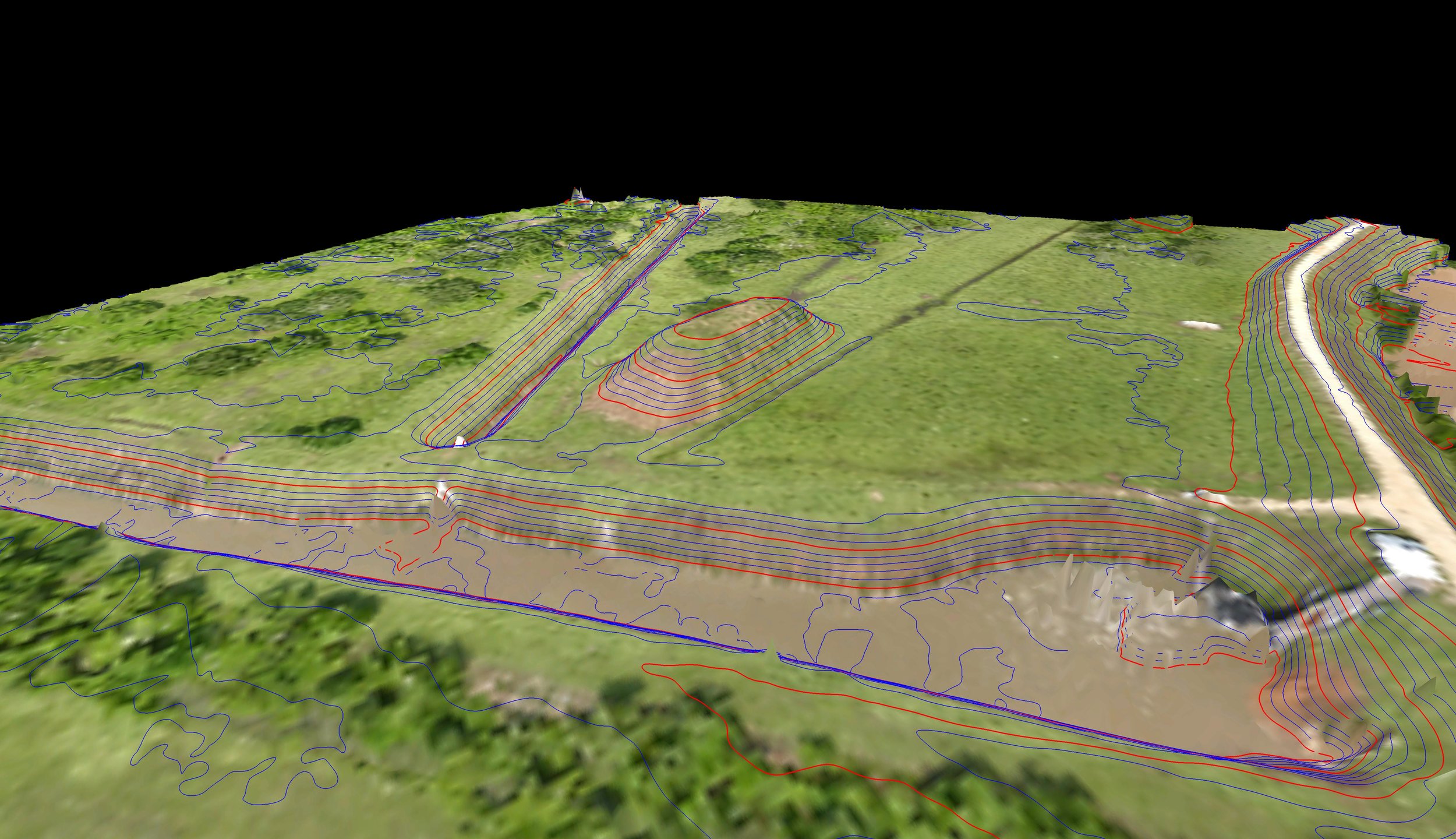
Topographic surveys are an important part of the planning process for new construction of review of the impact which existing construction has on the surrounding area. These surveys can be used for calculations to help determine if and where grading work needs to be completed, if construction equipment will have the proper amount of clearance around equipment, or to determine if a proposed site will meet the needs of the project. This kind of survey can include a variety of features including but not limited to; ground elevations and features such as ditches or ridges, above ground structures such as buildings, utilities including power lines, piping or valves, hydrographic studies of waterways or bodies.. The final scope of a topographic survey is determined by our clients needs. At Doyle & Wachtstetter, Inc. we have access to an array of experienced professionals who are able to assist our clients in determining the scope and needs of their projects to ensure we are able to generate a product which exceeds those requirements.
Topographic surveys are vital for many permitting applications which must be submitted and approved before construction begins. These may include ground contour information of the project area and any relevant areas which would affect the project. They can also be used for preliminary or post construction site plans, design preparations or calculations.
At Doyle & Wachtstetter, Inc. we utilize a diverse range of specialized equipment in order offer our clients the best options for topographic information, including traditional totalstations, RTK or PPK GPS units, Aerial Survey UAVs (fixed wing or rotors), High Definition Laser Scanners, Magnetic or Radio Detectors and a wide variety of software to process, calculate and visualize information in order to ensure you receive the best solution For the project.