
LEVERAGING 21ST CENTURY TECHNOLOGY WE GENERATE SUPERIOR DELIVERABLES AND DATA


Fast turnaround: Projects that traditionally could span weeks or months can be completed in 48 hours if necessary
Cost savings: Projects can be completed faster and more concisely for a cost that is less than or equal to the cost of traditional methods
Superior data: In a fraction of the time we collect millions of points, this leads to more accurate data and a clearer understanding of the subject area.
*If you have questions or would like additional information please contact Kim T. Doyle at 979-265-1071 ext: 118 or use the "CONTACT US" page
About


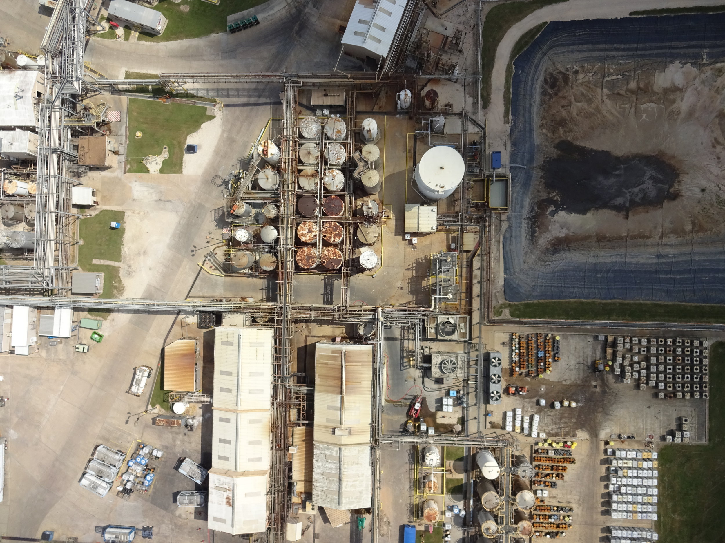
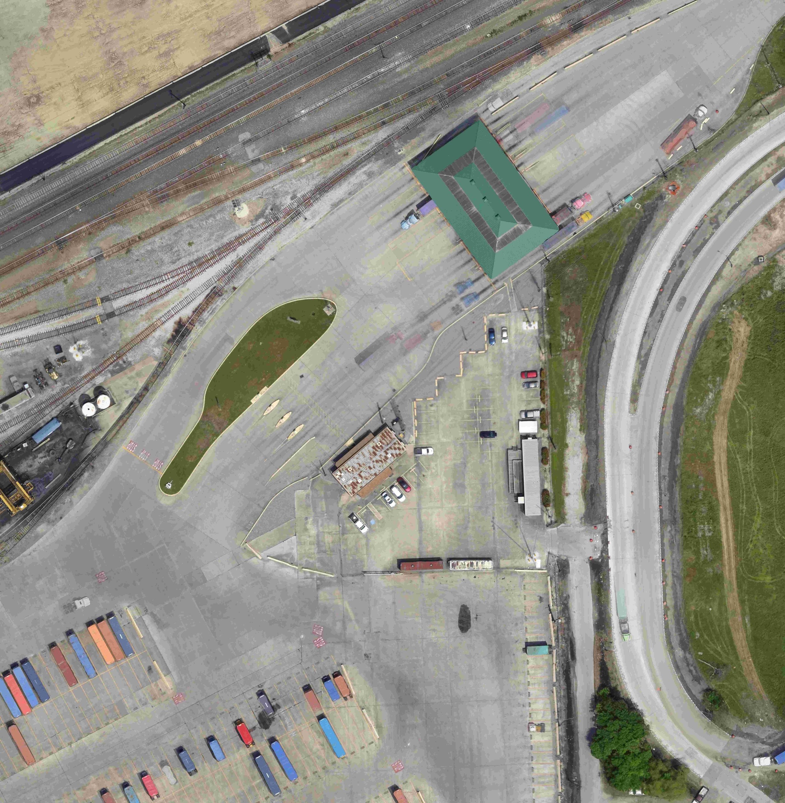
Using Unmanned Aerial Vehicles we deliver solutions to companies in the fields of: oil and gas, construction, chemical and process plants, environmental engineering, landfills, municipal planning, earth moving, and agriculture. for industrial mapping, pre-planning and as-builts
We have the capability to survey areas from a fraction of an acre to several hundred acres and can generate deliveries in the form of: aerial photos, 2D distance measurements, 3D volume calculation and analysis, 3D point clouds, contour maps, digital surface models, ortho-mosiac overlays, and site risk prevention and response.
As an alternative to traditional methods of obtaining survey data this technology vastly reduces project man hours and safety risks.